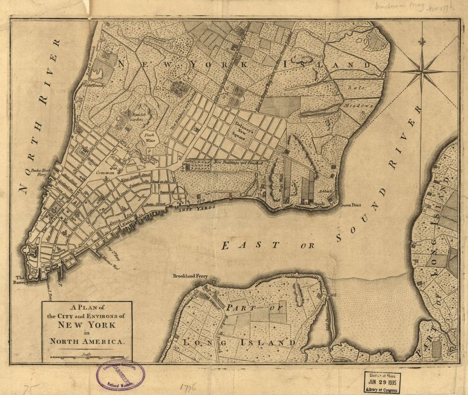
A plan of the city and environs of New York in North America
Item
-
Title
-
A plan of the city and environs of New York in North America
-
Description
-
General street map of New York City at the outbreak of the Revolutionary War, published in a British periodical. Built-up areas and field lines are defined. Indicated on the map are the "Road to Kings Bridge where the Rebels mean to make a stand" and "Road to Kepps Bay where the Kings troops landed". Also covers rural part of Manhattan Island up to present-day 14th Street and small parts of Long Island. The map provides a geography of the city, which at the time occupied only the lower portion of Manhattan Island.
Removed from: The Universal Magazine of Knowledge and Pleasure, London, Nov. 1776, v. 59.
-
Creator
-
Unknown
-
Publisher
-
Universal Magazine of Knowledge and Pleasure, London
-
Date
-
1776-10
-
Type
-
Cartographic
-
Format
-
1 map : mounted on cloth backing ; 29 x 37 cm., folded to 19 x 12 cm.
-
Language
-
English
-
Subject
-
- New York (N.Y.)--Maps--Early works to 1800
- Land use, Rural--New York (State)--New York--Maps--Early works to 1800
- United States--New York (State)--New York
-
Temporal Coverage
-
1776
-
Related Item
-
Original available at Library of Congress: https://www.loc.gov/item/2002623929/
-
Rights
-
Public Domain