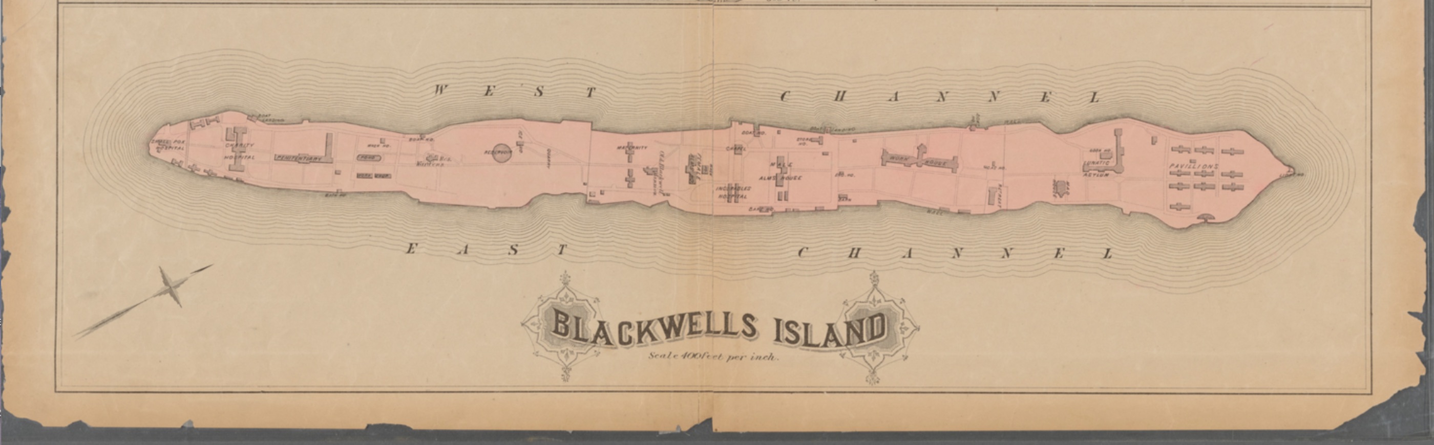
Map of Blackwells Island bounded by West Channel and East Channel (Plate # 41)
Item
-
Title
-
Map of Blackwells Island bounded by West Channel and East Channel (Plate # 41)
-
Description
-
This is an 1879 map of Blackwell's Island featuring the layout of medical and penal facilities. The specifically designated, individual buildings can be seen here as well as the fact that this community is geographically isolated by its island nature.
-
Creator
-
Cartographer, G.W. Bromley & Co.
-
Publisher
-
Lionel Pincus and Princess Firyal Map Division
-
Date
-
1879
-
Type
-
Map
-
Format
-
Cropped image scan of the physical map. Currently in JPEG format.
-
Language
-
English
-
Subject
-
Plate 41:: [Central Park bounded by Eight Avenue, 110th Street, Fifth Avenue and 59th Street; Blackwells Island bounded by West Channel and East Channel.]
-
Place
-
Blackwell's Island, New York, United States
-
Temporal Coverage
-
1879
-
Rights
-
Public Domain