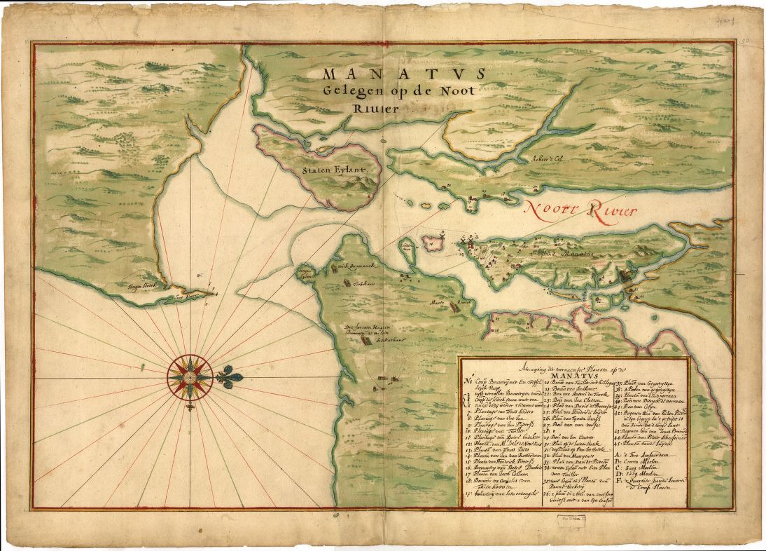
Mahatvs Gelegen op de Noot Rivier
Item
-
Title
-
Mahatvs Gelegen op de Noot Rivier
-
Subject
-
Manhattan (New York, N.Y.)--Maps--Early works to 1800
-
New York Region--Maps--Early works to 1800
-
Description
-
Map depicting buildings and points of interest within and around the colony of New Amsterdam. The map legend indicates letter F to be the location of slave quarters.
-
Creator
-
Johannes Vickeboons
-
Date
-
1639
-
Source
-
"Manatvs gelegen op de Noot [sic] Riuier." 1639. Available through the Library of Congress. URL: https://www.loc.gov/resource/g3804n.ct000050/
-
Rights
-
Public Domain, via The Library of Congress
-
Type
-
Manuscript/Pictorial Map
-
Format
-
JPEG
-
Language
-
Dutch/Flemish
-
Coverage
-
Colonization, Settlement, and Communities (1607–1763)