
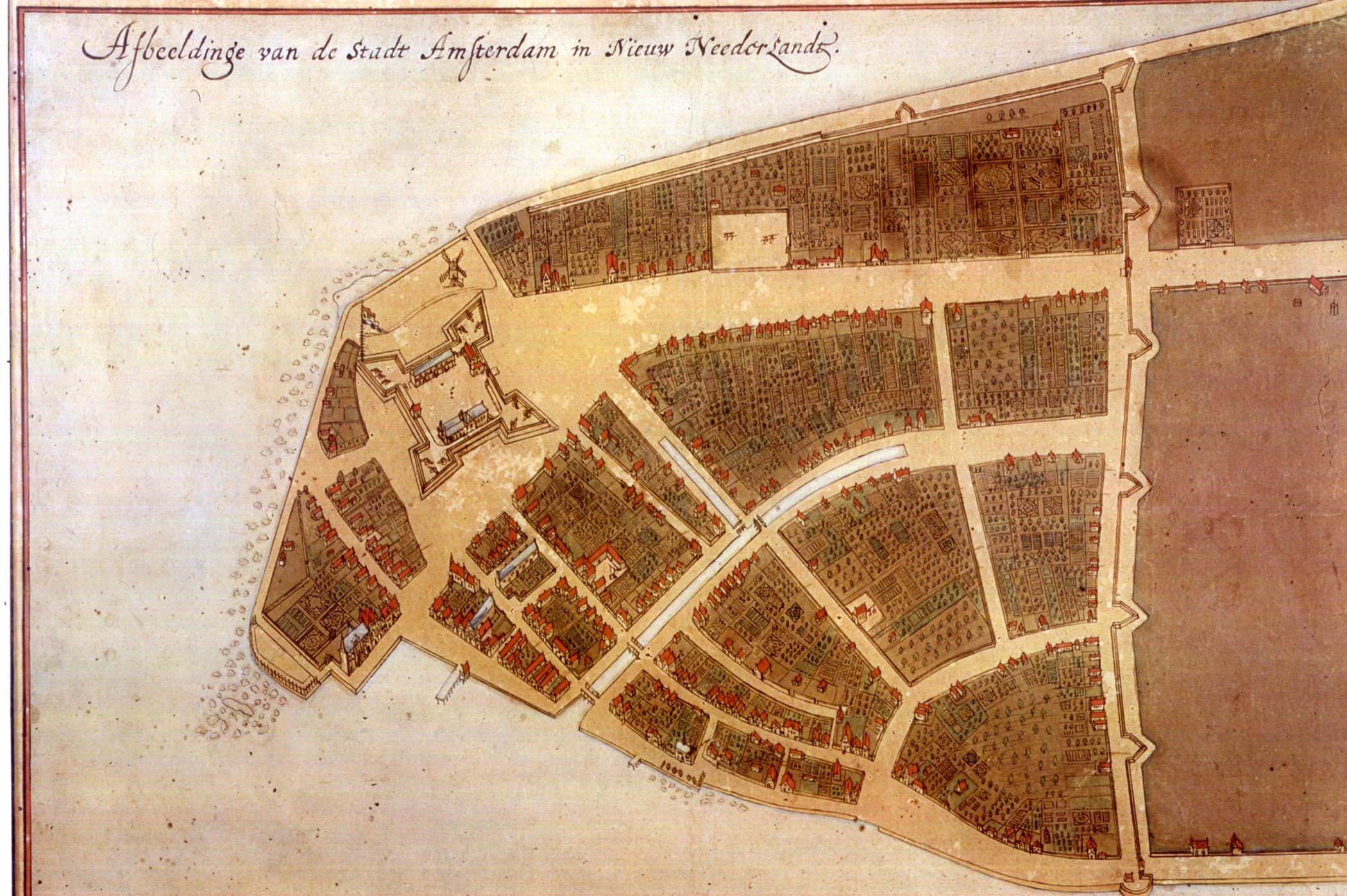
Castello Plan
Dublin Core
Title
Castello Plan
Subject
New York (N.Y.)--History--Colonial period, ca. 1600-1775
Dutch Americans
Economic history--1600-1750
Description
Map of New Amsterdam based on an original that has since been lost, which was created in 1660 by Jacques Cortelyou who served as Surveyor General of the early Dutch colony.
Creator
Unidentified Artist
Source
New York Public Library Digital Collection
Date
1665 - 1670
Contributor
Tracy McFarlan and Kaitlyn Tanis
Rights
Public Domain
Format
JPG
Language
Dutch
Coverage
New Netherland (1609 - 1664)
Map Item Type Metadata
Citation
New Amsterdam. Map. 1659. From Wikimedia Commons. https://en.wikipedia.org/wiki/Castello_Plan#/media/File:CastelloPlanOriginal.jpg. (accessed November 2016).
Files
Citation
Unidentified Artist, “Castello Plan,” Creating Digital History @ NYU, accessed September 17, 2026, https://aphnyu.org/creatingdigitalhistory/fall2016/items/show/5.
Embed
Copy the code below into your web page